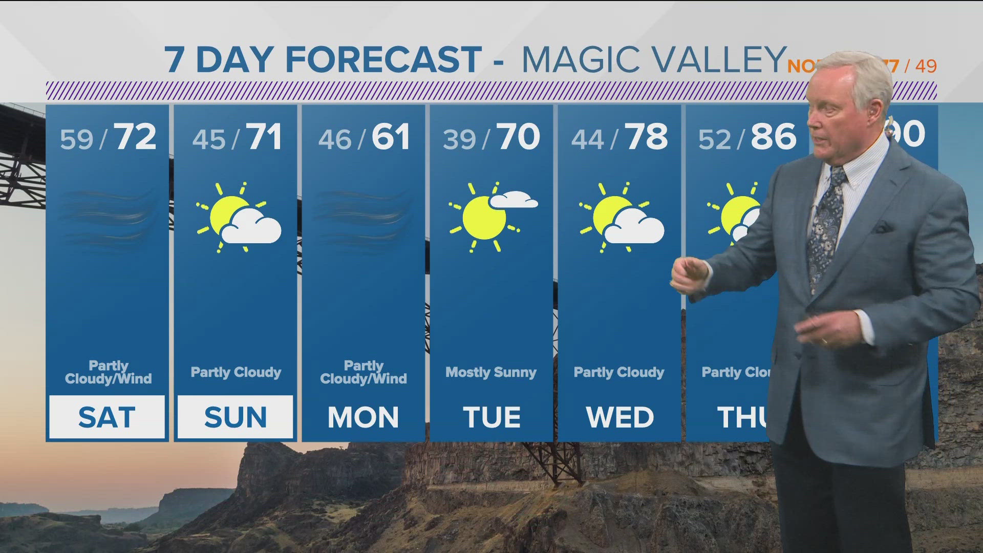
BOISE, Idaho — A phenomenon known as an Atmospheric River of Moisture will bring significant amounts of rainfall to the Treasure Valley in the next several days.
This is a large amount of precipitable moisture embedded in a cold front system and will take as many as 5-7 days for all of the moisture to move over the area. No one day will have enough showers to create a watch or a warning, but collectively the moisture will give us more than an inch total of rainfall in the lower valleys and several inches of snow in the mountains.
Showers will start on Friday and will continue into Friday night for the western edge of the area through much of the Treasure Valley and the west central mountains. Saturday will see a lull in the showers for the first part of the day, but more showers will move in by evening, as a series of storms crosses the region through the weekend and into early next week.
Temperatures are warm enough it will just be rain, not snow, even in the mountain communities. The freezing level is above 7,000 feet to start this event but cooling will take the freezing level down and produce snow as low as 5,000 feet.
The result will be rain in the low valleys but as much as 6-12 inches of snow in the mountains. This could easily be the start of the mountain snowpack as temperatures are not expected to warm very much in the coming days. The snow should stay in the mountains and set things up for additional snow that could lead to a healthy snowpack and sufficient levels of snow for the mountain ski areas.
The end of this Atmospheric River will be late Wednesday night with drying and only a little warming by Thursday.
Watch more weather:
See the latest weather forecasts and news in our YouTube playlist: