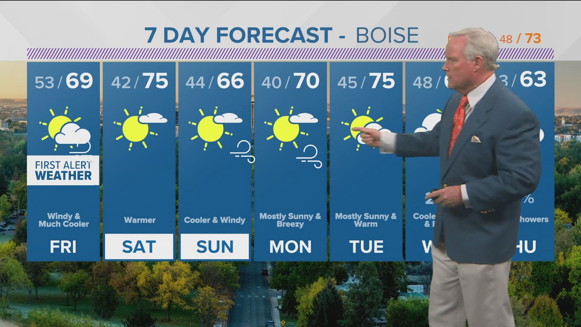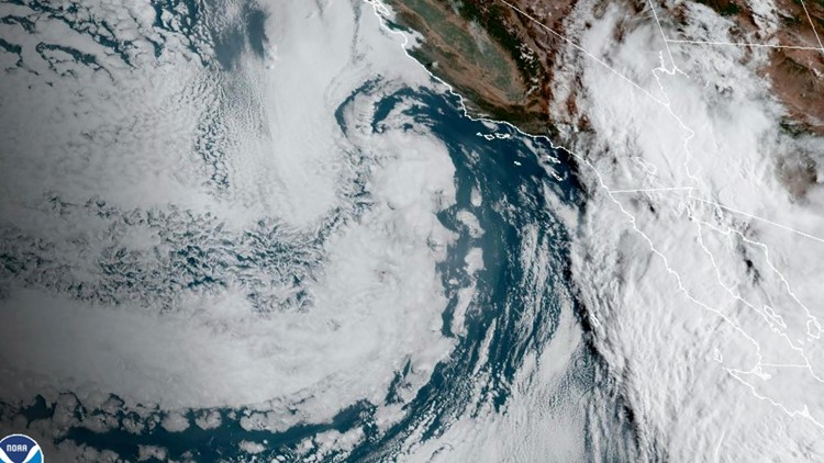
BOISE, Idaho — A hurricane – yes, a hurricane – will impact Idaho's forecast starting Sunday until Tuesday. Hurricane Hilary rapidly intensified to a category 4 storm before weakening to its current status, a category 2.
There was flooding as the storm hit Mexico's Baja coast Sunday and, as it moved, it brought large amounts of rain into California.
It's a potentially historic system, the last time a tropical storm made landfall in southern California was in 1939. There's a high possibility of flash flooding, flooding, landslides, and mudslides across the southwest US as this storm brings tropical moisture onshore; especially in desert areas where the rainfall rate could be 2-3" an hour. High elevation spots in California could see up to 15 inches of rain from Sunday to Monday. Powerful winds are also expected with this system.
Moisture from this storm will continue to be funneled north to Idaho. Mountain locations can expect rain and thunderstorms on Sunday, with the central mountains expected to see the highest total for Sunday. This will lead to chances of flash flooding in steep terrain, burn scars and areas near creeks or rivers. Valley areas will also see showers, but have a lower chance of seeing flooding for Sunday.
An additional, heavier round of moisture will be moving in overnight Sunday and expected to continue into Tuesday, making the flooding threat a continuous one for mountain areas. This secondary round of moisture will lead to a narrow band of higher rain totals. This area has been shifting with the forecast and likely will lead to some places seeing low rain totals while others may see very high ones.
Currently, the storm is still over the open ocean. The track it takes inland will directly affect how much moisture Idaho sees.
With this current track, 0.50" - 1.00" of rain is possible in Treasure Valley spots. Amounts will be even higher, in the mountains, up to 2.00", leading to localized flooding chances.
On average, Boise sees 0.17" of rain for the entire month of August. So far, we have seen 0.05" of rain in the City of Trees, but we could be adding lots of moisture to that if the current hurricane track holds.
The highest storm chances right now will be from Sunday to Tuesday. So, make sure you stay informed with your First Alert Weather team, we will keep you updated every step of the way with this variable forecast.
Watch more weather:
See the latest weather forecasts and news in our YouTube playlist:
HERE ARE MORE WAYS TO GET NEWS FROM KTVB:
Download the KTVB News Mobile App
Apple iOS: Click here to download
Google Play: Click here to download
Watch news reports for FREE on YouTube: KTVB YouTube channel
Stream Live for FREE on ROKU: Add the channel from the ROKU store or by searching 'KTVB'.
Stream Live for FREE on FIRE TV: Search ‘KTVB’ and click ‘Get’ to download.