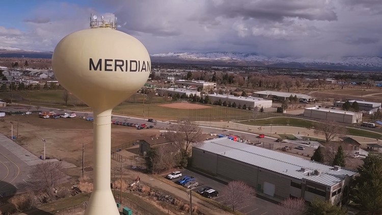
MERIDIAN, Idaho — As Meridian grows and changes, residents want their neighborhood identities and rural lifestyles to be protected. That’s according to Susan Karnes, a resident who participated in the city’s steering committee to update the comprehensive plan.
The debate over protecting Meridian’s rural heritage and planning for its urban future is at the heart of many residents’ concerns with the city’s proposed new plan, which the city council will consider for approval Tuesday, according to a report from the Idaho Press.
Meridian’s comprehensive plan hasn’t seen a major update since 2011, when the city had about three-quarters of its current population. The updated plan attempts to respond to that growth and Meridian’s transition to a more urban environment by including more high-density and mixed-use residential zoning plus more industrial zoning, and eliminating a rural/estate zoning designation.
The city and a steering committee — a group of residents, stakeholders and private partners — have been working on the update for a year-and-a-half. City planners presented the comprehensive plan and accompanying Future Land Use Map to the Meridian City Council at a Nov. 19 public hearing.
Karnes, along with hundreds of petition-signers from South Meridian, opposed getting rid of the rural/estate zoning.
“Eventually, (Meridian may) be an urban community, but we think it’s premature — especially when the stakeholders so strongly value our existing agriculture and semi-rural properties — to bundle them under low density,” she said at the hearing. “Even if it is just to identify existing uses, this is important to our stakeholders that we protect our rural heritage and our existing rural uses.”
Meridian City Council President Luke Cavener asked Karnes when, if not already, Meridian can be considered an urban community.
“I think it’s going to be your call,” Karnes replied.
Changes to low-density areas of the Future Land Use Map sparked opposition from some homeowners association representatives. At the public hearing, representatives opposed changing low-density areas of the map to uses that were higher in density, industrial or mixed-use.
The Future Land Use Map and comprehensive plans serve as guides for future development. Caleb Hood, Meridian’s Planning Division manager, said the comprehensive plan is meant to strategically guide growth, but it does not set development standards, annex or rezone properties, or propose new roads.
“We plan because we want to control our own destiny, to some degree,” Hood said. “We want to be forward-thinking and ensure that we are providing for the services and the land uses that we want, and if you don’t have a comprehensive plan, you’re likely to get whatever comes into your door.”
MAGIC BRIDGE
The new map proposes significant land-use changes to several areas of the city, including the Magic Bridge area, Southwest Meridian and the Black Cat-Cherry Railroad corridor.
The Magic Bridge area generally is east of Locust Grove Road, north of Interstate 84, west of Eagle Road and south of Franklin Road. Neighborhoods in Magic Bridge include Magic View, Woodbridge and Locust View Heights, according to a staff report on the comprehensive plan.
The area, which includes both city and Ada County property, is diverse in land use, age of structures and infrastructure, the staff report said, but “it suffers from extremely poor connectivity” to major arterial roads that surround it.
Of particular concern is the low-density-designated Locust View Heights, an aging Ada County subdivision consisting primarily of 1-acre lots that use wells and septic systems for water and sewer, respectively. The subdivision has no vehicular outlet to Eagle Road or connectivity to Woodbridge, a subdivision to the north, the staff report says.
RELATED: 'It's a land grab': Residents concerned over possible future changes to Meridian subdivision
Locust View Heights is in unincorporated Ada County but is included in Meridian’s area of impact, which means future developments there would likely annex into Meridian and use city services. The neighborhood is included in the city’s Future Land Use Map.
A Magic Bridge steering committee — a 22-person group made up of residents, stakeholders and agency partners who participated in the development of the city’s new comprehensive plan — recommended Locust View Heights remain a low-density neighborhood. But the city’s Planning Division and Planning and Zoning Commission, which provided recommendations for the comprehensive plan and Future Land Use Map, disagreed.
The staff report proposes changing Locust View Heights’ land-use designation from low-density residential to mixed-use residential, allowing for the city and relevant stakeholders “to address service issues, to improve connectivity and to provide new opportunities to capitalize on synergies with healthcare related education and employment,” the report says.
David Claiborne, a lawyer who spoke at the public hearing on behalf of Locust View Heights, said residents of the neighborhood oppose the mixed-use designation. Locust View Heights is a unique neighborhood that should be preserved, Claiborne said.
“It gives an opportunity for those that enjoy open space in their living area, fresh air, quiet, low traffic and a place where they can have larger animals,” he said. “There’s multi-generation families in the neighborhood, and it’s a neighborhood with a character that provides habitat and buffer between the freeway and more dense development.”
John Overton, who spoke on behalf of the Woodbridge subdivision, said Woodridge residents support the plans for the Magic Bridge area. Overton said the proposed land-use designations — mixed-use residential, medium-density residential and commercial to the east — would bring future developments to the Magic Bridge area that would create least amount of impact on current residents, Overton said.
SOUTHWEST MERIDIAN
The proposed comprehensive plan would eliminate a rural/estate residential land-use designation, which caps dwelling units at one unit per 5 acres. There are nearly 2,000 properties with that designation, located mostly in Southwest Meridian.
The rural/estate residential designation, adopted in 2012, allowed agricultural and open-space land to be preserved while allowing some low-density development, the staff report says. But the designation also cut off city services, such as sewer and water, for land behind homes with that designation, making it costly for the city to extend services to potential new developments.
“Because a city, by definition, is urban and not rural, the Rural/Estate designation is being removed from the Plan,” the staff report says. “As is the case with long-range planning efforts, circumstances change, people change and property owners change. With Meridian services still some ways off from the southwest, and with other agencies allowing for more density, some property owners now prefer to redevelop instead of remaining rural. Some of these parcels have annexed into other jurisdictions, undermining Meridian’s efforts to sustainably plan and preserve.”
Kenzie Ward, who spoke at the public hearing on behalf of the Rock Ranch Estates neighborhood in Southwest Meridian, said she and her neighbors oppose the elimination of the rural/estate residential designation. Rock Ranch is a neighborhood of mostly 5- to 10-acre properties where residents enjoy open spaces and a rural lifestyle, Ward said.
“Very few people have this opportunity to grow up with enough open space to have livestock and horses,” she said. “One of our biggest concerns with this draft of the (comprehensive) plan is the elimination of the rural designation, which makes our rural lifestyle, that we love, impossible for future families of Meridian.”
Ward said Rock Ranch residents oppose the Future Land Use Map designation for properties east of their neighborhood as well. The FLUM proposes Rock Ranch and nearby Stetson Estates, a similar rural estate neighborhood, be low-density; however, land to the east would be medium-density, meaning three homes could be built on 1 acre, Ward said.
Ward said the medium-density designation is a “huge misrepresentation of our current uses.”
BLACK CAT-CHERRY RAILROAD CORRIDOR
The Black Cat-Cherry railroad corridor encompasses an area south of Cherry Lane, east of McDermott Road, west of Black Cat Road and north of the railroad tracks, according to the staff report.
The area — mostly Ada County property and part of Meridian’s area of impact — primarily is designated as low- and medium-density residential in the city’s current Future Land Use Map. But the city is hoping to change a substantial portion of the area to industrial use.
“There is a need to designate more lands in Meridian’s Area of City Impact for future industrial uses,” the staff report says. “Even today, industrial land is in short supply and the City often struggles with missed employment opportunities due to limited availability. Industrial land with rail access is even more limited.”
City planning staff recommend a general industrial land-use designation from the railroad tracks north about a half-mile and east of McDermott to West Pine Lane. The area is home to rural estates and small farms.
Eighty-one residents signed a petition opposing the general industrial designation, according to Jain Byam, a resident of the area on El Gato Lane.
“There will ... be immediate negative impacts to the residents in the general industrial area use classification, (which) can be expected to inversely impact current marketability as low-density residential properties,” Byam said. “The preservation and protection of the current way of life for the residents in the effected area ... and the avoidance of adverse impact to existing agricultural, small-acreage properties is a key element of the comprehensive plan.”
The city council is planning to vote on the comprehensive plan at its Nov. 26 meeting, which begins at 6 p.m. at Meridian City Hall, 33 E. Broadway Ave.
More from our partner Idaho Press: Without reaching a compromise with county officials, Caldwell to reconsider urban renewal district proposal
Watch more 'Growing Idaho':
See them all in our YouTube playlist: