

IDAHO, USA — **Alerts and weather conditions are subject to change. For the latest, most up-to-date information, go to KTVB's weather alert page.
A head's-up to Idahoans commuting Thursday evening and Friday - driving conditions are likely to worsen overnight Thursday with the season's first significant winter storm.
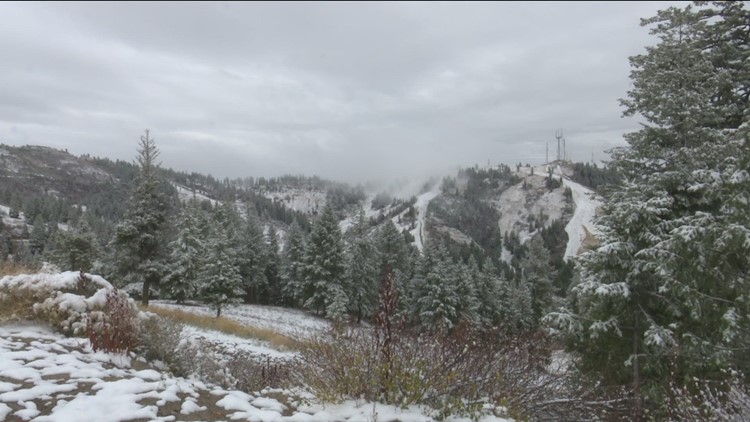
The first major snowstorm of the 2023 winter season is expected to bear down on the region late Thursday. The storm system will be accompanied by snow (heavy in some areas) and wind gusts, making driving conditions challenging for evening and morning commuters.
The National Weather Service (NWS) issued a Winter Weather Advisory for the Treasure Valley and mountain areas, spanning into eastern Oregon. The advisory is in effect until Saturday at 5 a.m., as of Thursday.
Idahoans can anticipate snow to fall at most elevations within the weather advisory boundary.
Following the issued Winter Weather Advisory, NWS then downgraded the weather alert to a Winter Storm Watch - in effect from Saturday at 5 a.m. through Sunday evening.
The NWS alert, Winter Weather Advisory, means that the winter weather being forecasted is imminent. Less threatening is a Winter Storm Watch alert - which indicates that winter weather conditions are still favorable, however, have lower probability of being significant, according to NWS.
KTVB's meteorological team predicts 1 to 2 inches of snow for the western Treasure Valley, 2 to 5 inches for upper Treasure Valley areas and 1 to 4 inches in the Magic Valley.
The dusting won't last long for Treasure Valley residents, however - as snow will transform into rain at lower elevations on Saturday, with a slight increase in temperatures.
Individuals at higher elevations can expect heavy snow to continue throughout the weekend.
RELATED: Increasing clouds with late PM snow into Friday (1-4" valleys)
RELATED: Track local weather conditions provided by Idaho's largest, most experienced team of meteorologists
Wind gusts early Friday morning are expected to create periods of blowing snow, making travel very difficult to impossible. So, with the arrival of wintry conditions, here's a refresher on driving in winter weather conditions:
- Drive slowly and brake early, the Ada County Sheriff’s Office advises.
- Be aware of black ice on roadways, which can result in vehicle slide-offs.
- Keep some essential items like a blanket, food and water, in your vehicle.
- Snowplow courtesy:
- BPD says do NOT pass on the right of snow plows. For visibility purposes, motorists should pass plows on the left.
- Give them plenty of space.
STAY TUNED TO WEATHER UPDATES ON KTVB CHANNEL 7, 24/7 AND ON KTVB.COM AS THIS STORMY PERIOD DEVELOPS.
Post your photos using Near Me in the KTVB app and you can also share them in our Idaho Weather Watchers Facebook group.
Watch more Local News:
See the latest news from around the Treasure Valley and the Gem State in our YouTube playlist:
HERE ARE MORE WAYS TO GET NEWS FROM KTVB:
Download the KTVB News Mobile App
Apple iOS: Click here to download
Google Play: Click here to download
Watch news reports for FREE on YouTube: KTVB YouTube channel
Stream Live for FREE on ROKU: Add the channel from the ROKU store or by searching 'KTVB'.
Stream Live for FREE on FIRE TV: Search ‘KTVB’ and click ‘Get’ to download.
