
IDAHO, USA — March 1st marks the beginning of meteorological spring, which means, meteorological winter, the months of December, January and February, is now in the books. Here's a little winter 2022-23 wrap from all across the country and also of course, right here in Idahome.
Inevitably, winter is always a wild ride somewhere in the country, and where on the map winter weather is wreaking havoc can change from day to day.
This season, in some regions, winter was really weird. In the Northeast, it has been more like the "winter that wasn't":
For example, in Boston, Massachusetts it’s been a “wicked warm wintah,” ranking as the 5th warmest winter on record. It’s also been the 4th least snowy winter on record through the end of February with less than a foot in the books. Compare that to a seasonal average of 44 inches. Many New England ski areas had to limit operations, and even shut down not long after the start of the New Year.
In New York City's Central Park, the first measurable snow of the season didn’t fall until February 1st, which is the latest on record. Total seasonal snow so far stands at 2.2 inches, compared to a seasonal average of 30 inches.
Pittsburgh, Pennsylvania saw more 70-degree days in February than tenths of inches of snow. February 2023 now goes down as the least snowy on record there with less than a quarter of an inch throughout the entire month.
Washington DC logged its warmest winter on record with less than a half-inch of snow for all of winter so far.
In long-time drought-stricken California, several atmospheric river events aimed the firehose on the Golden State, leading to historical flooding and nearly 50 FEET of mountain snow in the Sierra Nevada Range. Just this past weekend, snow accumulated in otherwise sunny southern California, and there's more wild weather for the West Coast expected this week.
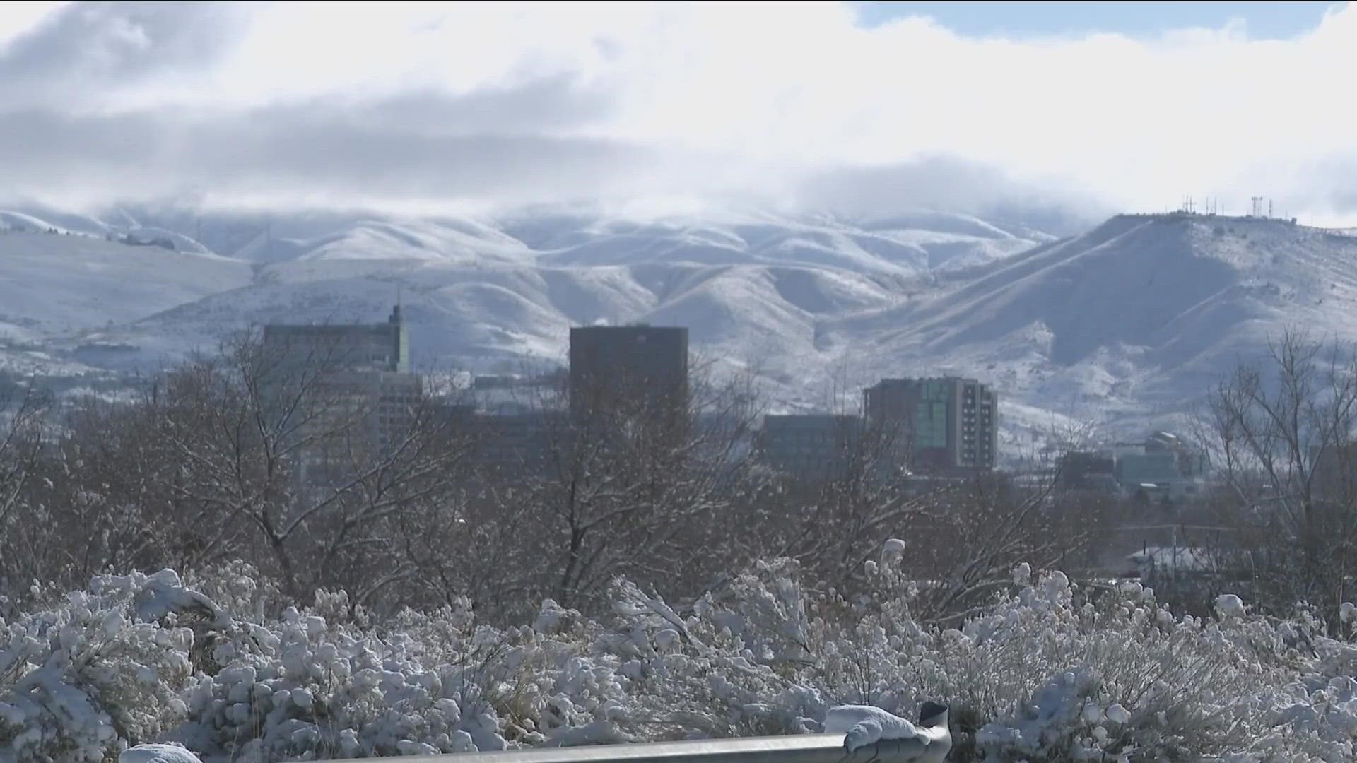
Back here at home, you may be surprised to learn that meteorological winter 2022-23 has been “business as usual.” We saw some ups and downs, and a little bit of everything in between, but it all averaged out pretty close to normal. There were some high impact weather days, like the super sweet snow-day on December 12th. There were also many fantastic days to enjoy the freshy-freshy-pow-pow at area ski resorts. Brundage, for example has picked up more than 220 inches this season, with Bogus boasting over 200 inches.
And the snowpack for the region has stayed near or above average and is still close to average moving into spring. Focusing on the central part of the Gem State, near the Big and Little Wood River Valley, snowpack is currently around 120% of average. It hasn't been this high at this point in the year since 2019. This is great news for the drier months ahead.
Before winter officially began, the First Alert Weather team shared our Winter 2022-23 Outlook (link to this?) explaining this winter was expected to be a La Nina "three-peat,” or the third consecutive year with cooler than average water in the equatorial pacific. There weren't many examples in the record books of "three la Nina winters in a row,” so that was a bit of a wild card of what we might expect.
Our forecast called for near average, or slightly above average snowfall, and here's where the snow totals stand as of the final day of February:
For Boise: 19.8 inches, compared to an average of 16.3 inches
For McCall: 124 inches, compared to an average of 112 inches
This is pretty close to our First Alert Forecast for the winter, and not too far off from the other examples of a "three-peat" La Nina winter. Plus, we didn’t have too many of those socked-in-with fog temperature inversion days, as the weather stayed consistently active.
Now as we get closer to the official start of spring, we can slowly let all of those worries about winter go, because the bulk of the cold and snowy season is behind us.
However, it appears that even though meteorological winter is over with February behind us, winter weather wants to stick around into spring. Colder than average temperatures are favored to continue through March, and possibly even into April and May. Plus, as we’ve seen this week it's likely that it's not time to put the snow shovel away yet.
One thing we know for sure is we'll be ready for it all, and the KTVB First Alert weather team will work hard to always be your first alert for the high impact weather days ahead.
Watch more Local News:
See the latest news from around the Treasure Valley and the Gem State in our YouTube playlist: