
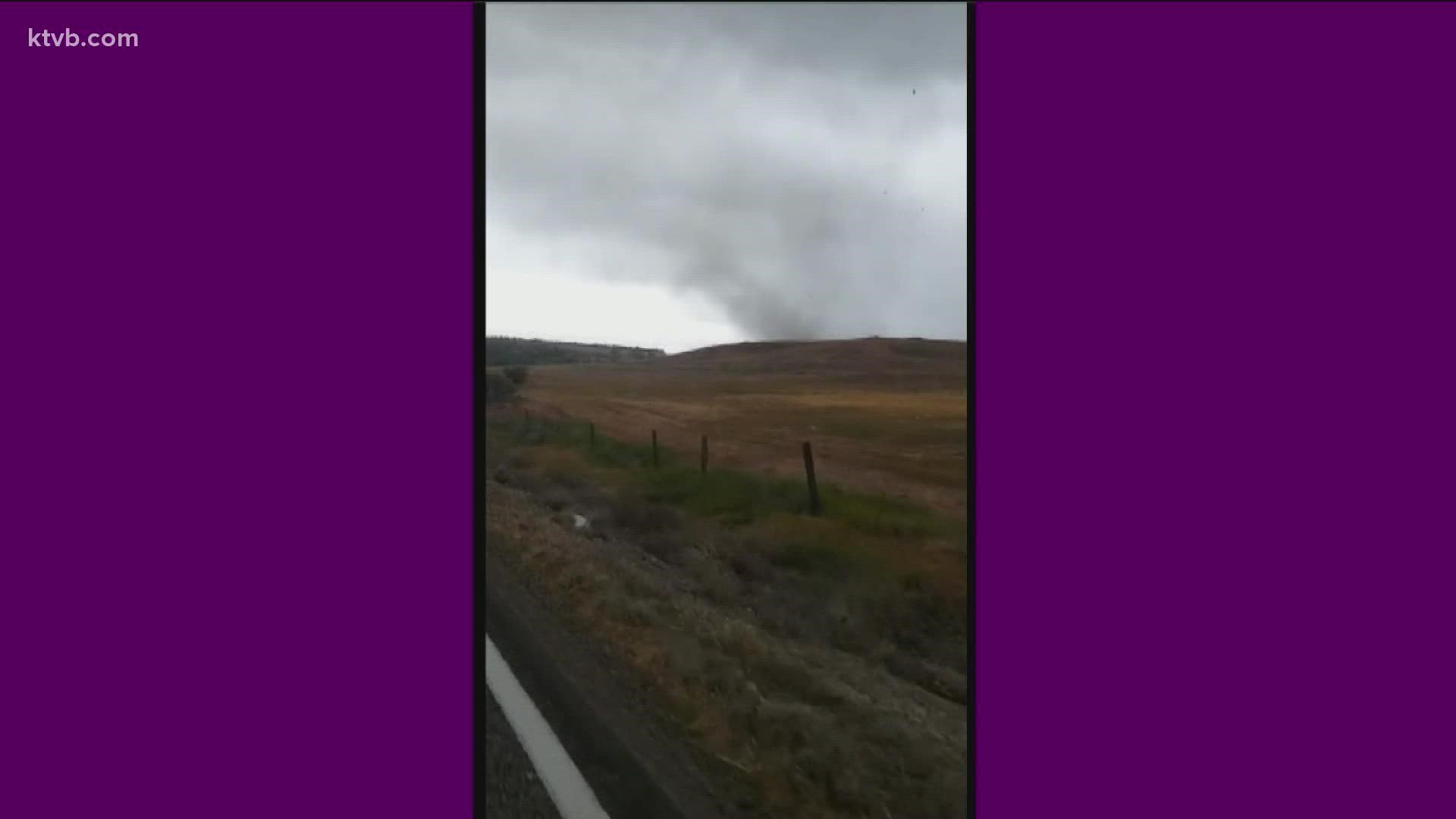
MARSING, Idaho — An employee with the National Weather Service (NWS) in Boise spotted a tornado crossing a highway southeast of Marsing on Friday, as storms moved through southern Idaho.
The NWS employee observed the tornado around 5 p.m., as winds reached an estimated 65-75 mph. In the video posted to Facebook Saturday, NWS described the whirlwind as a, "weak, EF0 tornado."
The tornado can be seen approaching Idaho State Highway 78 in the video, before eventually crossing the road. Friday's video was taken about a mile northwest of Givens Hot Springs or 9 miles southeast of Marsing.
According to NWS, the tornado was estimated to be on the ground for 15 minutes, with a path around 5 miles. The twister originated in the northwest area of Owyhee County.
Friday's video of the tornado from the National Weather Service in Boise can be seen below:
According to KTVB Meteorologist, Bri Eggers, times of showers, thunderstorms, much cooler air and mountain snow are expected for Memorial Day weekend in southern Idaho.
If you have plans to be in the mountains this holiday weekend, be prepared for colder, wet weather, with the likelihood of snow accumulations as low as 6,000 feet by Sunday and Monday. Snow will fall as low as 4,500 feet early Monday, but likely not accumulate.
Saturday is expected to be the most-decent weather day of the three-day weekend, with another wave arriving late Saturday night. Periods of rain are in the forecast through Sunday and lingering into Monday.
Watch more weather:
See the latest weather forecasts and news in our YouTube playlist: