
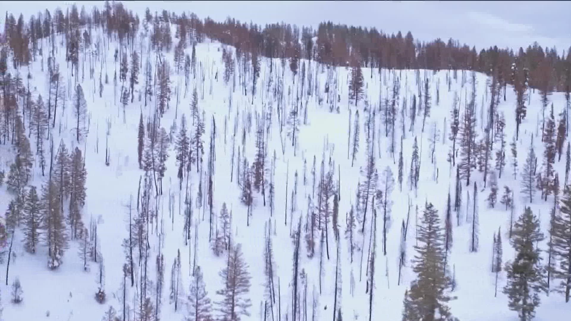
BOISE, Idaho — Parts of Idaho have been dealing with drought for several years now, but a strong start to snowpack this season could help.
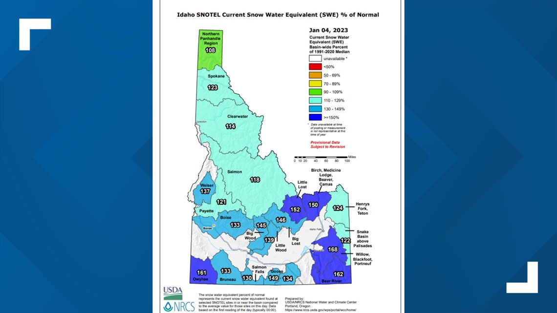
All of Idaho is seeing above-average snowpack levels. Everywhere south of the Salmon River has greater than 120% of average snowpack for this time of year.
However, Idaho is only about halfway through the snow season, which starts in October and lasts until April - when snowpack peaks.
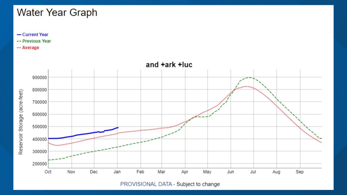
"We're early in the season and to see numbers like in the Boise Basin, we have 136% of normal snowpack, but that's only 50% of our way up to the peak. We've got a long ways to go," Idaho Department of Water Resources hydrologist David Hoekema said. "When you look at the total situation in the Snake Basin, really only the Boise and Payette are in a good water supply situation."
Hoekema said the Boise River water supply is in an ideal situation with above-average storage. Full storage allocations on the Boise River are likely and it is expected that the Boise River will have adequate water supply next season.

Snake River is facing a more-bleak situation, and high-drought risk continues in the Upper Snake River Basin in eastern Idaho. The Snake River system is facing about a million acre-foot deficit compared to normal.

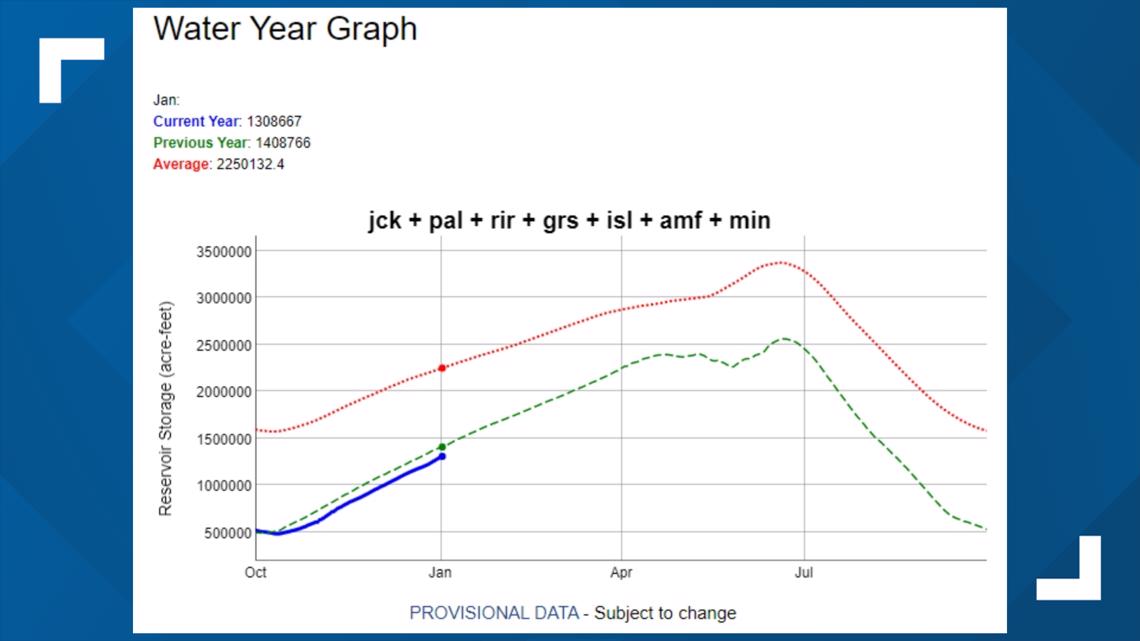
"So, that's what we have to make up with that above-normal snowpack," Hoekema said. "That's kind of the difference between those two systems. The Boise is really in an ideal situation and the Snake is completely in another type of situation where they're really depending on a strong snowpack to recover from drought. If they have just a regular snowpack or less, drought will continue."
Snowpack levels are similar to where they were at last year, when La Niña conditions slowed snow accumulation around Jan. 8. La Niña conditions are still present this year.
"The implication there is that we have to continue having this above-average snowpack. We don't want to see any type of ridge setup over the Pacific that blocks storm systems coming in, because if that happens, it will be another year of drought across the rest of southern Idaho," Hoekema said. "But at least we're starting strong, but we're likely to be in our third year of drought next year, unless the snowpack continues to build the way we're seeing it build."
Hydrologists can only wait for Mother Nature to see how the rest of the snow season shakes out. Hoekema said Idaho should have a good indication of how things will go in the coming weeks.
"We've been in a long drought cycle and the likelihood is it's more likely to continue than not," Hoekema said. "So, I do want to get the message out there not to be overly excited about the snowpack until probably the end of January, maybe the end of February. If that snowpack is still continuing to accumulate the way we're seeing it now, that's when we would start calling for a drought reduction across the rest of southern Idaho."

Watch more Local News:
See the latest news from around the Treasure Valley and the Gem State in our YouTube playlist: