
BOISE, Idaho — The Sawtooth Avalanche Center issued avalanche warnings for all zones Tuesday, stating that the avalanche danger is considered 'high' or 'extreme.'
In a Twitter announcement, the avalanche center said they had received several reports of "very large avalanches already this morning."
As of noon on Tuesday, the Big Wood River, near Hailey, was blocked by recent avalanche activity and considered to be impassable.
The Sawtooth Avalanche Center said they anticipate conditions to worsen into Tuesday night. The center said that avalanches will be large enough to dam rivers, snap trees and may even be capable of destroying wood-framed homes.
"Today is not the day to be anywhere near, on, or under a steep slope," Sawtooth Avalanche Center forecaster Ethan Davis said. "So, that includes roadways, trails and structures that sit beneath some of these really big slopes. We just have extraordinarily dangerous avalanche conditions. We expect more of these avalanches to occur this afternoon and evening as conditions get worse."
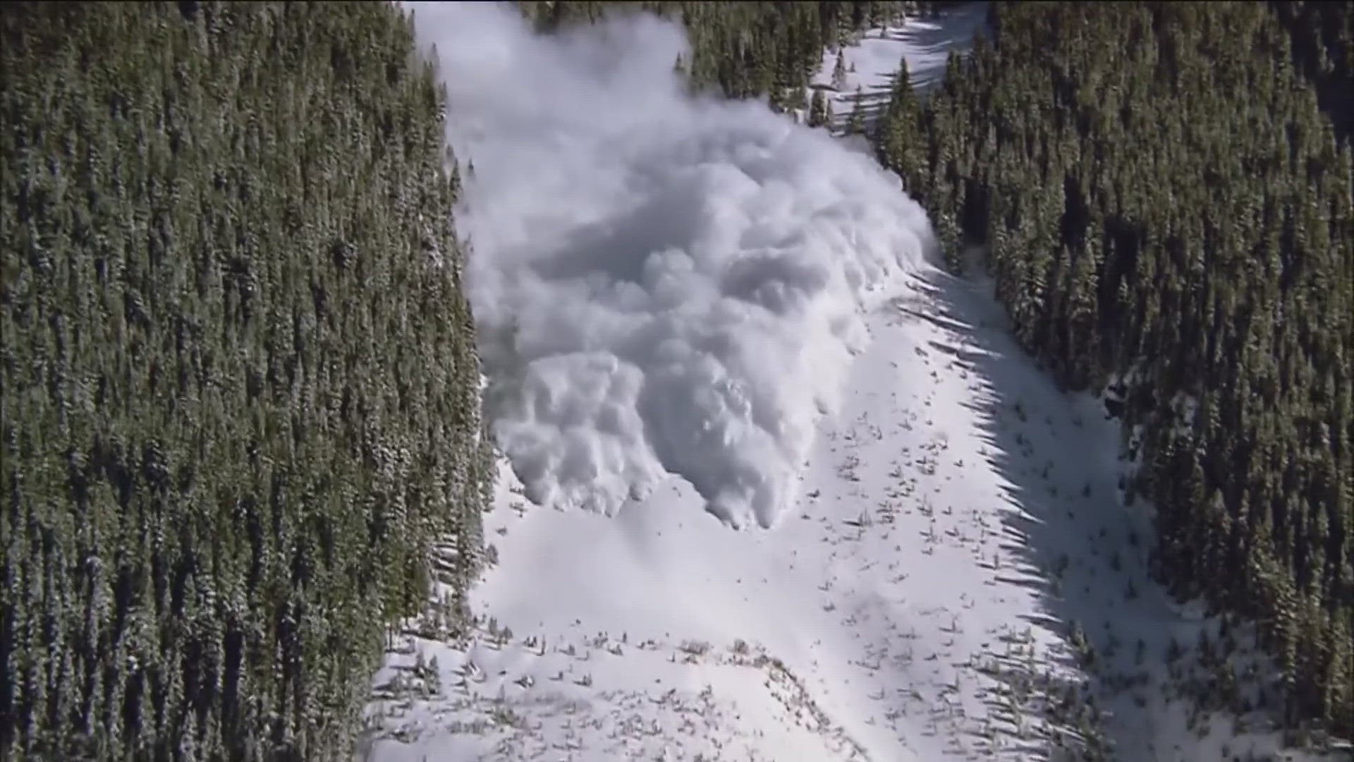
Avalanches have pummeled the Sawtooth region for several days. Dry conditions in February weakened the area's snowpack, turning the snow into a weak, faceted snow that couldn't hold the snow from recent storms.
Faceted snow, combined with rain and warming temperatures, created a "historic" avalanche cycle on Friday.
"Snowfall at the end of February and into the beginning part of March really built up a thick slab - or just a cohesive layer of snow above those weak facets, and that was what caused the avalanche cycle last Friday," Davis said. "It's also what's contributing to the avalanche cycle this time around."
Avalanches from Tuesday's cycle have blocked parts of the Big Wood River, hit two homes in Ketchum, and crossed Warm Springs Road - leaving behind a pile of debris.
Another concern under current conditions in the Sawtooth region are roof avalanches - where snow piles on top of a roof, and as temperatures warm, snow can slide off - which could cause the whole roof to slide.
The Sawtooth Avalanche Center expects avalanche risk to remain extreme overnight and into Wednesday morning. Avalanche risk will likely be high tomorrow.
To stay safe during high and extreme avalanche conditions, the Sawtooth Avalanche Center recommends completely avoiding avalanche terrain.
The Sawtooth Avalanche Center provides daily avalanche forecasts that can be viewed here.
Recent Avalanche Activity:
On Monday, March 13, the Idaho Transportation Department (ITD) said it had cleaned up 14 avalanches, and anywhere from a foot to 21 inches of snow to reopen State Highway 21 by Saturday afternoon. A stretch of the highway is often referred to as "avalanche alley."
On Sunday, March 12, one person was killed by an avalanche while snowmobiling in the Sawtooth National Recreation Area. According to the Sawtooth Avalanche Center, three people were riding when the victim was caught in the avalanche and buried over a meter deep in snow.
Sunday, March 12, Warm Springs Road in Blaine County had to be closed due to avalanches. Road crews had cleared eight avalanches form the road as of Sunday evening.
Multiple highways across Idaho were closed Friday, March 10, as extreme winter weather passed through the area. Both lanes of US-20 were closed between Mountain Home and Fairfield due to drifting snow and poor visibility.
Avalanche Danger Scale:
The North American Public Avalanche Danger Scale (NAPADS) is a system that rates avalanche danger and provides general travel advice based on the likelihood, size, and distribution of expected avalanches.
It consists of five levels, from least to highest amount of danger: 1 – Low, 2 – Moderate, 3 – Considerable, 4 – High, 5 – Extreme.
Although the danger ratings are assigned numerical levels, the danger increases exponentially between levels. In other words, the hazard rises more dramatically as it ascends toward the higher levels on the scale.
For updates on road closures across Idaho, drivers should check Idaho 511 and ITD's Twitter account.
Watch more Local News:
See the latest news from around the Treasure Valley and the Gem State in our YouTube playlist: