
BOISE, Idaho — Wildfire season in Idaho got underway a bit earlier than usual, due in part to Idaho’s drought conditions, which have led the Gem State to be at an above-normal risk for significant fires, according to the National Interagency Fire Center (NIFC).
NIFC predicted that the increased fire risk will last through September, peaking in July and August. The news conference included officials from the Bureau of Land Management, United States Forrest Service, Idaho Department of Lands and Idaho Firewise.
All agencies are urging the public to help prevent wildfires and reduce risk during extremely dry conditions.
To protect your home during this fire season the Idaho Firewise said people should remove debris from their property – that includes the gutter and below the deck. People should also have a five-foot barrier of gravel around their home and store firewood at least 30 feet away from their home.
Scroll down to see interactive maps of all wildfires burning in Idaho, Oregon, California and across the West Coast.
Note: This list will be updated as more information about the fires becomes available.
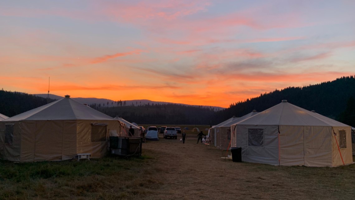
Fires burning in Idaho
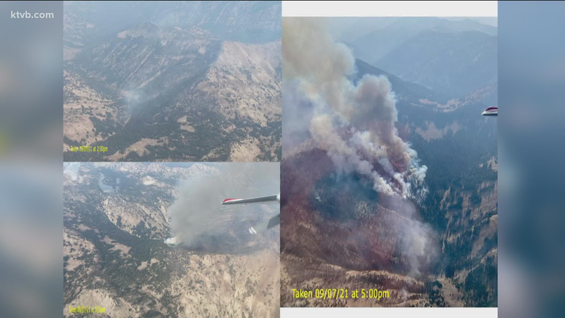
The Boundary Fire is located about two miles west of the Boundary Creek Boat Launch and 29 miles northwest of Stanley, Idaho. It is on steep, inaccessible terrain within the Frank Church River of No Return Wilderness. As of Tuesday, October 12, it has burned 87,778 acres, or about 137 square miles. It is 88% contained.
Fire activity has been minimal. Moderate amounts of snow fell late Monday and early Tuesday, and light snow continued later Tuesday. More snow is expected Wednesday.
A point-protection strategy is being used on this fire. Point protection is defined as a wildfire response strategy that protects specific assets or highly valued resources from the wildfire without directly halting the continued spread of the wildfire. Values at risk are defined as property, structures, physical improvements, natural and cultural resources, community infrastructure, and economic, environmental, and social values such as the Middle Fork River corridor.
The fire was detected August 10, with the cause believed to be lightning. It is burning in lodgepole pine, spruce, Douglas fir and subalpine fir trees.
Closures: An area, road and trail closure order was terminated Friday, October 8.
Other information: The Boundary Fire information phone number is 208-510-8437. It is staffed from 8 a.m. to 8 p.m. each day.
The Boundary boat launch is closed for the season.
Backcountry airstrips are open to general aviation. Pilots should coordinate with Central Idaho Dispatch and monitor the backcountry radio frequencies.
As of October 12, four personnel were assigned to the Boundary Fire, which is located on the Salmon-Challis National Forest.

The Dixie and Jumbo fires are located about 40 miles southeast of Grangeville and 15 miles south of Elk City, near the communities of Dixie and Comstock. As of September 15, the fire was estimated to have burned 46,500 acres -- almost 73 square miles -- and was 63% contained.
No significant fire activity has been reported since September 15. The estimated date for full containment is Oct. 30.
The fire was detected on the afternoon of July 5 by aviation resources. Fire managers say it was ignited by lightning.
The Idaho County Sheriff's Office lifted all related evacuation orders effective on August 10th.
As of Tuesday, October 12, the Mud Lick Fire, 22 miles west of Salmon, had burned 20,857 acres and was 70% contained. Just a few areas of heat remained, with smoldering and creeping.
A moderate amount of snow fell overnight Monday and early Tuesday. Another low-pressure system is expected to bring more snow on Wednesday.
One person was assigned to the fire as of October 12. The U.S. Forest Service continues to monitor the fire by air. Full containment is expected October 19.
The lightning-caused fire started July 8 and is burning in grass, brush, dead/down timber, and ponderosa pine and Douglas fir trees on the Salmon-Challis National Forest.
Fires burning in Oregon
Note: Some information regarding Oregon wildfires comes from our Portland affiliate KGW.
Located about 25 miles south of Unity, Oregon, on the Malheur National Forest, the Black Butte Fire was fully contained on September 30. It has burned 22,445 acres.
The fire was first detected the morning of August 3. Lightning is believed to be the cause.
The Bootleg Fire, in parts of Klamath and Lake counties, burned 413,717 acres -- or more than 646 square miles, an area more than double the size of New York City. The fire's perimeter is now 100% contained, but the fire destroyed dozens of homes after a lightning strike started it in early July. As it grew over 39 days, smoke from the Bootleg complex could be seen and smelled across the U.S., all the way to the East Coast.
Major roads are now open again and all evacuations have been lifted.
A list of other fires burning in Oregon as well as in southeastern Washington state is available here.
Interactive maps of fires burning in Idaho, Washington, Oregon and California:
Watch more on wildfires in the West:
See all of our latest coverage in our YouTube playlist: